21 Aug, 2026 | Barker Francisco | No Comments
The Ha Giang Loop: Vietnam’s Most Legendary Road and the Riders Who Conquer It
Some venues are made legendary by the athletes who perform in them. The Olympic Stadium in Berlin became immortal the day Jesse Owens won four gold medals. Wembley carries the weight of Geoff Hurst’s hat-trick. Beijing National Stadium belongs to Usain Bolt.
Roads can be the same. And in northern Vietnam, there is one road that has become the defining test of a specific kind of endurance — the kind that sits at the intersection of physical skill, mental resilience, and the willingness to push through environments so extreme they seem designed to stop you.
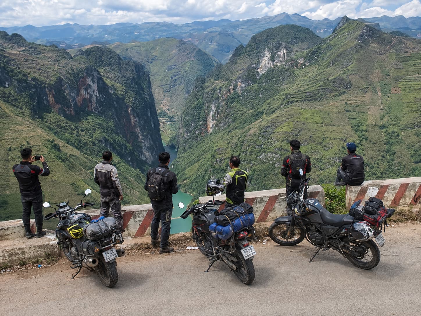
The Ha Giang Loop is approximately 350 kilometers of mountain road through Vietnam’s northernmost province. It is, by the consensus of riders who have completed it, one of the most demanding and spectacular motorcycle routes on the planet. The passes run to 1,500 meters above sea level. The hairpin bends number in the hundreds. The views from the summit of Ma Pi Leng Pass — a canyon dropping hundreds of meters to the turquoise Nho Que River below — are the kind that make seasoned riders sit down and stop talking.
This is the arena. The athletes who enter it are the tens of thousands of riders who attempt the loop each year, from seasoned motorcyclists to first-timers gripping handlebars with white knuckles, all of them facing the same mountain.
The Route: What Riders Are Up Against
The Ha Giang Loop runs northeast from Ha Giang City through a UNESCO-recognized Dong Van Karst Plateau Geopark — one of the oldest geological formations in Southeast Asia, with limestone peaks that have been rising and eroding for 500 million years. The terrain is not incidental. It is the challenge.
Bac Sum Pass is the loop’s opening statement. Riders climb from the valley floor to an elevation of roughly 900 meters through a series of switchbacks that immediately separate confident riders from those who need to recalibrate their approach. The views from the summit look back over Ha Giang City and forward into the karst valleys that define the rest of the route. Most riders who turn back at Bac Sum do not turn back because the road beat them. They turn back because the view from the top makes them want to stay forever rather than continue.
Quan Ba Heaven’s Gate sits at 1,500 meters, where the road crests a ridge and opens into a panorama of the Twin Mountains — two perfectly domed limestone peaks rising from a valley floor far below, so symmetrical they look engineered. The technical challenge here is not the summit. It is the descent on the far side, where the road drops steeply through tight corners that require riders to brake with precision and trust their tires on stone that becomes treacherous when wet.
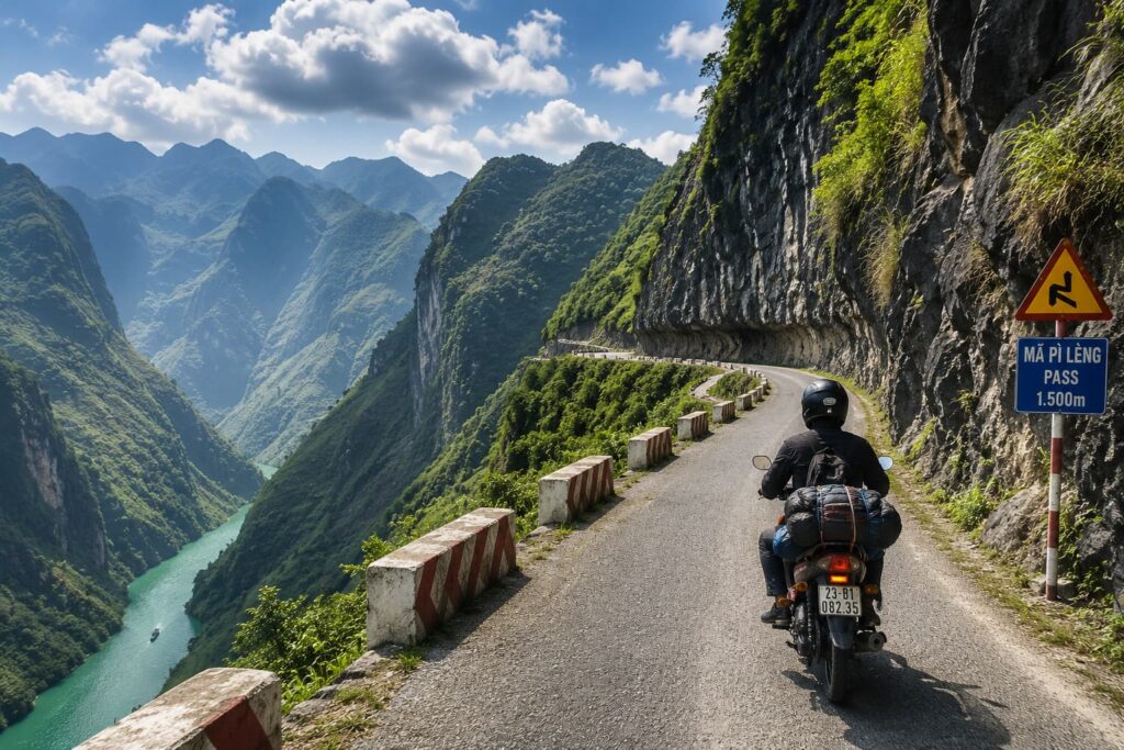
Ma Pi Leng Pass is the loop’s defining achievement. The name translates roughly from the H’mong language as “the nose of a horse” — a reference to the narrow ridge the road traverses. The pass runs for approximately 20 kilometers along the edge of a canyon that is one of the deepest in Southeast Asia. The road itself is cut directly into the cliff face. To the left: stone wall. To the right: a drop into the Nho Que River, hundreds of meters below, visible in flashes of turquoise between the rock outcroppings.
Riders who complete Ma Pi Leng report a specific physical sensation: a combination of sustained adrenaline and hyper-focused attention that leaves the body buzzing for hours afterward. The road demands every second of concentration. It does not permit distraction. And when it ends — when the canyon opens and the road descends toward Meo Vac town — the exhale is audible even with a helmet on.
The Records: What Makes the Ha Giang Loop Notable in Human Performance Terms
The Ha Giang Loop does not have world records in the traditional sporting sense. There is no official timing, no standardized race format, no sanctioned competition. What it has instead is a body of accumulated human performance data that makes it one of the most seriously documented endurance routes in adventure travel.
The most-booked guided tour through Ha Giang Tours — the 3-Day/2-Night Ha Giang Loop with private room — has over 9,400 documented completions, with a 5.0 average rating from verified riders. That number matters the same way a stadium’s attendance record matters: it represents a specific, verifiable measure of how many people showed up, tested themselves, and came away marking it as peak experience.
The route itself has been completed by riders ranging from 18 to over 70 years old. It has been ridden on 110cc semi-automatic bikes by people who had never operated a motorcycle before. It has been completed in three days and in seven. It has been ridden in buckwheat flower season when the valleys turn pink and white, and in monsoon season when the road surface becomes a different kind of challenge entirely. The diversity of completions does not diminish the achievement. It reveals that the loop’s difficulty is genuine but navigable — the same way a well-designed stadium course challenges every athlete who enters it without being impossible for any of them.
The pass height record within the loop — Ma Pi Leng at its highest traversal point — sits at approximately 1,500 meters above sea level. At that altitude, engine performance on underpowered bikes drops measurably. The air thins enough that riders unaccustomed to altitude feel it in their lungs on longer climbs. The temperature differential between the valley and the summit can exceed 15 degrees Celsius. Experienced riders know to layer up before the ascent and strip off on the descent. First-timers learn this mid-climb.
The Athletes: Who Rides and What It Takes
Every sporting venue defines the athlete it produces. Beijing National Stadium produced a generation of sprint performances at the highest level because the environment, the timing, and the stakes demanded them. Ha Giang produces a different kind of athlete: the endurance rider who combines physical skill, risk tolerance, mechanical intuition, and the specific mental quality of sustained presence across three to five days of mountain terrain.
The self-ride contingent — riders who complete the loop on rented bikes under their own control — represent perhaps the purest expression of the athletic challenge. These are motorcyclists who navigate 350 kilometers of hairpin passes, gravel sections, blind corners, and altitude changes using their own skill and judgment. The license requirements for this category are real and enforced: Vietnamese police run checkpoints on the Dong Van road and around Meo Vac, and riders without a valid International Driving Permit endorsed for motorcycles face fines and occasionally confiscated bikes. The physical requirement is genuine riding ability. Not enthusiasm — ability.
The Easy Rider format produces a different kind of performance. Riders who choose an experienced local guide as their driver — sitting pillion on the back of the bike while their guide navigates — give up direct control of the machine but gain access to a level of local knowledge that changes the experience qualitatively. The Easy Rider guides on the Ha Giang Loop are not tour bus drivers. They are athletes in their own right: riders who know every corner of the route through hundreds of completions, who read road conditions by sound and feel, who can maintain a 110cc bike at altitude without mechanical tools, and who do this five days a week for months at a stretch. Their endurance across a season of loop riding would be remarkable in any sporting context.
The Jeep contingent includes riders who attempt the loop in open-air military vehicles — army Jeeps from the Vietnam War era that have been adapted for mountain touring. The physical challenge here is different from motorcycling: the Jeep covers the same terrain but requires its driver to manage a heavier, less maneuverable vehicle through the same tight corners. The suspension transfer on the rougher secondary roads means passengers absorb significant impact over a full day of riding. The 3-Day Ha Giang Loop Private Jeep Adventure through Ha Giang Tours has over 2,400 completions and a consistent 5.0 rating — evidence that the Jeep format is not a softer version of the loop. It is a different physical test with its own demands.
Ma Pi Leng: The Most Famous Stage
If the Ha Giang Loop is a stadium, Ma Pi Leng Pass is center court.
The pass achieved international recognition gradually, through a combination of motorcycle travel writing, photography shared on social media, and the Vietnam government’s designation of the Dong Van Karst Plateau as a UNESCO Global Geopark in 2010. That recognition drew attention to the geology — the ancient limestone formations, the canyon carved by the Nho Que River over millions of years, the ecological uniqueness of the high-altitude plateau — and with it came the riders.
The “Happiness Road” (Đường Hạnh Phúc) that traverses Ma Pi Leng was constructed between 1959 and 1965, built primarily by H’mong and Tay ethnic minority laborers using hand tools across terrain so extreme that sections of the road required carving directly into cliff faces. The human effort involved in building the road predates any competitive achievement on it by decades, and the knowledge of that history gives the pass an additional dimension for riders who know it. You are not just conquering a mountain road. You are riding on something that people built with their hands through conditions that would stop any modern construction equipment.
The technical specifications of the pass — the elevation profile, the corner radius measurements, the sight distance at specific points — are not publicly catalogued the way a stadium’s dimensions are. But experienced riders develop a specific vocabulary for it: the “dead corner” at the third major hairpin where the road bends and the canyon drops simultaneously, the “flat section” three-quarters of the way through where the road briefly widens and riders use it to breathe, the final descent into the Nho Que valley where the turquoise river becomes visible in full and every rider stops whether they intended to or not.
The Ethnic Minority Villages: The Cultural Stage
No great sporting venue exists only for the performance that happens inside it. Estadio Azteca carries Mexican football culture through every brick. Wembley is inseparable from the history of English sport. The Ha Giang Loop is inseparable from the H’mong, Tay, and Dao communities who live along it.
The H’mong are the numerically dominant ethnic minority group in Ha Giang Province, with a history in these mountains that extends back centuries. Their villages are built into hillsides at altitudes where farming is possible only through the construction of elaborate terraced rice paddies — engineered landscapes that have been built and maintained across generations and that cover the mountain slopes in the geometric patterns visible from every viewpoint on the loop. The rice terrace engineering is, in its own way, as impressive as any stadium construction: hundreds of meters of stone-walled agricultural terracing following the contour lines of the mountain, holding soil and water in positions where neither should naturally stay.
Riders who stop at the village of Lung Tam encounter women producing the indigo-dyed handwoven textiles that H’mong culture is known for. The weaving process is physically intensive — the looms are traditional, the dyeing process requires repeated immersion and drying cycles — and the products of it are the most visible cultural artifact of life on the loop. Riders who spend time at these stops rather than passing through carry home a different understanding of the mountains.
The Hmong King’s Palace at Dong Van — built by the Vuong family in the early 1900s with craftsmen brought from China, using locally quarried stone — is one of the most architecturally sophisticated structures in northern Vietnam and one of the least known outside the province. For riders who stop there, it provides a historical anchor for the landscape the loop travels through: evidence that these mountains have sustained complex political and cultural life long before motorbikes existed.
The Best Time to Ride: Performance Conditions
Every athletic venue has an optimal season. Arrowhead Stadium in Kansas City performs at its loudest when the cold amplifies the crowd. The Ha Giang Loop performs at its most spectacular between September and December.
September and October bring golden rice terraces — the flooded paddies of the planting season have been replaced by stands of ripe grain that turn the mountainsides amber and gold. Riders in these months encounter photography conditions that make every viewpoint worth stopping for. The light at altitude in October, before the winter overcast sets in, produces the images that define Ha Giang in most international coverage of the route.
October and November bring buckwheat flowers. The buckwheat crop planted on the high-altitude plateau above Dong Van and Meo Vac blooms in pink and white across valley floors and hillsides, creating a visual effect that photographers travel from other countries specifically to capture. Riding through buckwheat flower season at altitude in Ha Giang is not a quiet experience for the riders who encounter it for the first time.
April and May offer a secondary window — milder temperatures, blooming landscapes, lower tourist numbers than peak autumn season. The loop’s roads are drier than summer and the light has a quality different from autumn that experienced photographers prefer for certain types of landscape work.
June through August is monsoon season. The athletic challenge during this period shifts from skill and endurance on difficult roads to survival on genuinely dangerous ones. Landslides are documented every rainy season. Visibility in cloud cover on the passes drops to meters rather than kilometers. The loop can still be ridden in this window by experienced riders willing to adjust schedules constantly, but the conditions it produces are different in kind from the autumn and spring windows. Ha Giang Tours provides current-season guidance on road conditions that is worth consulting before committing to a rainy season ride.
How to Attempt the Loop
The Ha Giang Loop is not a passive spectator experience. It requires riders to make decisions before they start that determine the quality and safety of everything that follows.
The fundamental choice is between self-riding, using an Easy Rider guide, or using a Jeep. Self-riding requires a valid International Driving Permit with motorcycle classification — not just any IDP, but specifically one issued under the 1968 Vienna Convention, which Vietnam recognizes. Police checkpoints on the Dong Van road are real and regular; the fine for riding without documentation runs to approximately $80 to $120 per incident, and riding without the right documentation almost certainly voids travel insurance in the event of a serious accident.
The Easy Rider option solves the documentation issue by putting a licensed local driver on the bike. For riders who are not confident motorcyclists or who are visiting Ha Giang specifically for the scenery and cultural experience rather than the mechanical challenge, this is the honest choice. The best Easy Rider guides on the loop have done the route hundreds of times and bring a quality of local knowledge about the road, the villages, and the homestay families that self-riding cannot replicate.
The loop takes a minimum of three days. Four is better. Five allows genuine exploration. Riders who attempt it in two days produce an experience closer to endurance racing than travel — possible, but defeating the purpose. The stops, the village encounters, the homestay dinners cooked by families who have hosted riders for years, the sunset from Ma Pi Leng — these are what the loop is actually made of. The road is the venue. The experience is the performance.
Ha Giang Tours compares and books the full range of loop formats, from the most popular 3-Day/2-Night guided Easy Rider tour at $180 per person to private Jeep adventures at $398 and multi-day packages extending to four and five days. The UNESCO Global Geopark information center in Dong Van maintains resources on the geological heritage of the plateau that riders who want to understand what they are riding through will find genuinely useful.
The Legacy of the Loop
Great athletic venues earn their status through the performances they witness over time. The Ha Giang Loop has been earning its status for over two decades of documented rider completions, with the volume increasing dramatically as the route gained international recognition through travel media and social photography in the 2010s.
What it produces in the riders who complete it is a specific kind of testimony. People who have ridden the loop describe it the same way people describe finishing a marathon or climbing a significant peak — not as a pleasant experience, but as a defining one. The physical challenge is real. The mental challenge is real. The reward is proportional to both.
The loop does not make headlines the way a world-record sprint does. It does not generate the crowd noise of Arrowhead or the political drama of the 1936 Olympics. But for the riders who return to Ha Giang province year after year — and there are guides and Easy Riders who have completed the loop more than a thousand times — it provides the same thing every great athletic venue provides: a specific test of human capability against a fixed and uncompromising standard.
The mountain does not move. The pass does not get easier. The river does not get closer to the road. The only variable is the rider.
[For more on sports history, legendary athletic venues, and the places where human performance reaches its peak, explore the articles on this site.]
About the author: Written by a motorcycle travel writer with extensive experience on endurance routes across Southeast Asia, including multiple Ha Giang Loop completions in different seasons.